Announcing gogeos, a spatial data library for Go
I am announcing the initial release of gogeos, a library for the Go programming language. gogeos provides spatial data operations and geometric algorithms. While it is a Go library, the hard work is done by the GEOS C library.
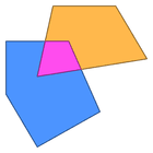
The kinds of things you can do with gogeos include:
- set-theoretic operations, such as computing the intersection, union, or difference of two geometries,
- topological operations, such as computing buffers and convex hulls,
- binary predicates, such as whether two geometries intersect or are disjoint,
- validity checking, and
- much more.
It also provides interoperability with other spatial data processing systems like PostGIS by decoding and encoding geometries as Well-Known Text (WKT) and Well-Known Binary (WKB).
I started working on gogeos because I looked at the landscape of GIS and spatial data libraries for Go, and found it lacking. Binding to the GEOS library with cgo was a way to get started quickly. Relying on GEOS has its drawbacks, for instance, it creates a large binary dependency, and cgo doesn’t allow for cross-platform compiles.
In the long term, I would like to create a pure Go library that implements functionality such as GEOS and the JTS provide. That would allow for use on platforms that don’t or can’t support C shared libraries, such as Google App Engine, and make it easier for developers to get started working with it.
In the meantime, I hope that gogeos enables more developers who are working with spatial data or GIS to get involved in the Go ecosystem.
gogeos is a fully open-source project, and I welcome contributors and feedback.